
Bear Creek Historical Project:
A Study of the Land and It's People
Geography
Natural Environment
The People
British Attack
Rememberance
The Future
Acknowledgements
Resources
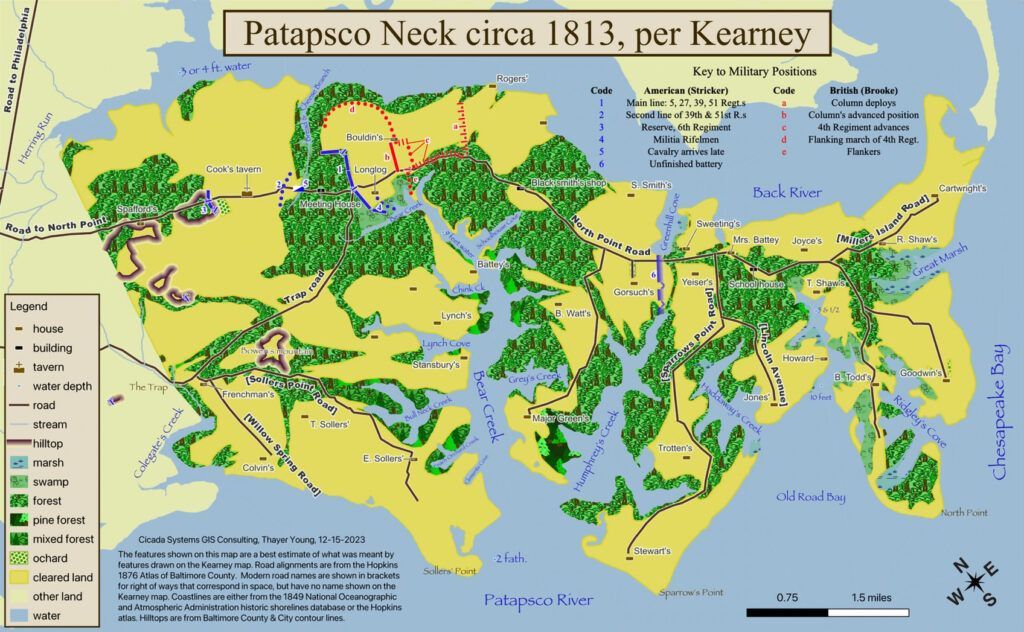
THE NECK
Patapsco Neck, sometimes called North Point Peninsula, is a low-lying sand and gravel-covered peninsula, with a maximum elevation of about 20 feet above sea level.
It begins just to the east of the City of Baltimore. From a line that runs from Colgate Creek in the south to Herring Run in the north, Patapsco Neck runs generally SE to Chesapeake Bay where it ends at the North Point-Fort Howard area. Encompassing approximately 35 sq miles, only about 23 sq miles of that is land. The other 12 sq miles is water in the form of creeks, inlets, and marsh.
GEOGRAPHY OF PATAPSCO NECK
GEOLOGY AND SOIL
The majority of Patapsco Neck is influenced by a geologic base of gravel, sand, silt, and clay. Under them are cobbles and boulders. When these silts, sands, and clays, mix with organic material like leaves and other decomposing plant materials, they form different kinds of loam soils that are good for agriculture. The particular loams found along Patapsco Neck range from strongly acidic to very strongly acidic making them good for growing white oak, scarlet oak, loblolly pine, red maple, yellow poplar, sweet gum, and magnolia trees.
THE NATURAL ENVIRONMENT
Patapsco Neck’s natural environment had an effect on virtually everything that was done along its length. In order to understand human activities along the Neck, one must first understand its natural environment.
CREEKS AND BAYS
At the time Europeans arrived along Patapsco Neck, roughly one-third (7,000 acres) of the peninsula consisted of water and two-thirds of the peninsula (14,000 acres) was land. The vast majority of the water was in the form of creeks and coves. Bounded on the north by Back River and on the south by the Patapsco River, it was their waters that formed the creeks and coves of Patapsco Neck.
Patapsco Neck’s creeks and coves are tidal, and along with the tide comes salt water. Therefore, the waters around Patapsco Neck are slightly to moderately brackish. This has an effect on the vegetation in and around the water as well as fish, amphibians, and animals.
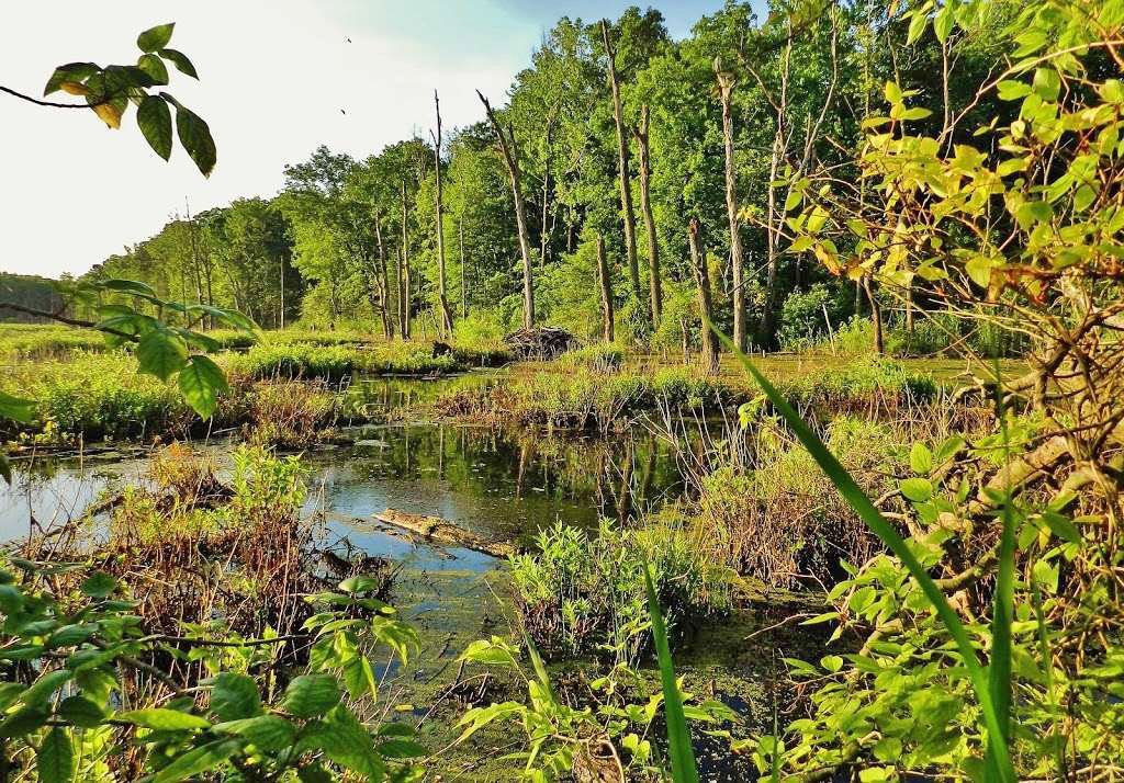
The natural environment of Patapsco Neck’s tidal wetlands as displayed in Black Marsh. (Photo courtesy of Matthew Beziat)
PLANTS AND ANIMALS
When Europeans first explored Chesapeake Bay, Patapsco Neck was heavily forested with several types of oak (red, white, and black), chestnut, both red cedar and white, cypress, black walnut, and poplar. Pine, dogwood, sassafras, black locust, and hickory could also be found. Local soils would have supported inkberry, American holly, wax myrtle, blueberry, honeysuckle, poison ivy, switchcane, redbay, butterfly weed, and greenbrier.

▴ A native part of Baltimore County’s natural environment, butterfly weed roots were used by Native Americans as a cure for pleurisy and pulmonary ailments. The fibers from the dry stems are used for building twine and the flowers can be crushed up and mixed with oils to put on bruises and cuts to promote quicker healing. (Photo Courtesy of NeighborSpace of Baltimore County)

▴ Pileated woodpeckers are part of Patapsco Neck’s native environment. (Photo by Nancy Wyman)
THE MARSHLAND HABITAT
At the time Europeans first came to this area in the 1600s, they would have observed three topographies along Patapsco Neck: land, water, and marshland. Those marshlands, in particular, were crucial to life along the Neck. They supported a wide variety of ferns, grasses, sedges, cattails, bulrush, and alders. Virginia creeper, climbing hempweed, swamp rose, and bittersweet nightshade made their home along the Neck. The tidal wetlands formed a habitat that supported a variety of amphibians, birds, and larger animals. Frogs, salamanders, snakes, and turtles abounded. Located along the Atlantic flyway, Patapsco Neck is still both a permanent and migratory home for birds such as the great blue heron, little blue heron, egret, swamp sparrow, osprey, bald eagle, hawk, downy woodpecker, pileated woodpecker, and red winged black bird. In addition to those birds, the marshes supported many game birds: ducks and geese visited the Neck in their hundreds of thousands. At the time Europeans first explored the area, larger animals like muskrat, raccoons, fox, wolves, black bear, and cougars also roamed the peninsula.
THE PEOPLE OF PATAPSCO NECK
NATIVE AMERICANS
Before Europeans arrived, two Native American peoples shared what is now Baltimore County for the purpose of hunting, fishing, gathering, and trade. To the north, in the vicinity of the Susquehanna River, lived the Susquehannock. To the south, near the Potomac River, lived the Piscataway.
The area between the Patuxent River in the south and the Gunpowder River in the north was a shared resource between both the Piscataway and Susquehannock during times of peace. It could be freely transited for trade purposes, hunting, fishing, and gathering. At certain times of the year temporary camps might be set-up, but no evidence suggests that long-term Native American settlements existed in Central Baltimore County or along Patapsco Neck.
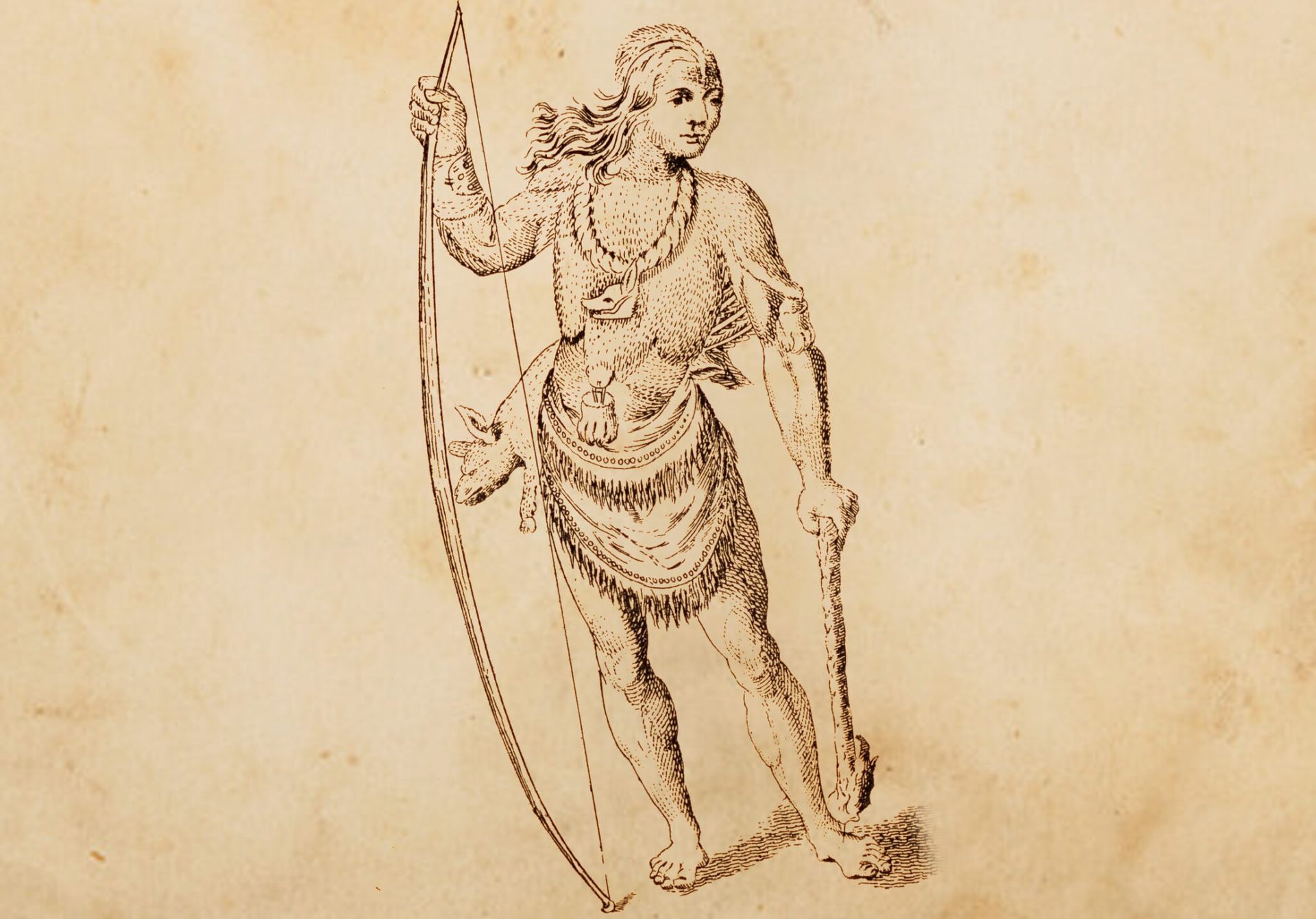
Susquehannock warrior as drawn on Capt. John Smith map from 1624
Susquehannock
The Susquehannock lived at the northern end of Chesapeake Bay near the Susquehanna River. Known as fierce fighters, they lived within palisaded villages that protected their longhouses. Outside the walls of their villages were fields for maize (corn), beans, and squash. Hunting and fishing provided deer, elk, black bear, fish, freshwater mussels, wild turkey, and waterfowl. Foraging supplemented their diet with wild plants, fruits, and nuts. Traders, they rapidly adjusted to trading furs with Europeans in return for European tools, glass beads, and, later, muskets. Their diet was varied and seasonal.
Piscataway
Farther to the south, the Piscataway people lived along the north bank of the Potomac River. Similar to the Susquehannock, Piscataway villages consisted of several longhouses protected by a log palisade. They relied on agriculture which enabled them to live in permanent villages. Their crops included maize (corn), several varieties of beans, melons, pumpkins, squash, and tobacco, which were cultivated by women. Men hunted bear, elk, deer, and wolves, as well as smaller game such as beaver, squirrels, partridges, and wild turkeys. They also fished and harvested oysters and clams. Women gathered berries, nuts and roots in order to supplement their diet.
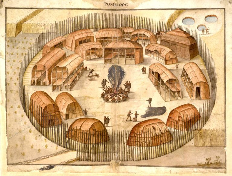
Early drawing of Native American longhouses located inside a palisaded village. Both the Susquehannock and Piscataway people lived in communities like this surrounded by farm fields. (Courtesy of the National Park Service)
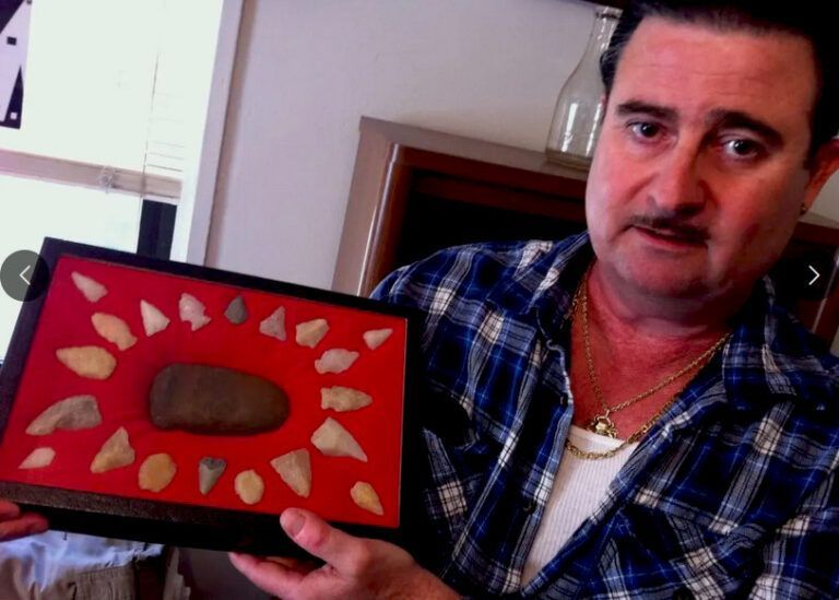
Vincent Sala of Dundalk displays some of the many Native American tools and projectile points he has uncovered through a lifetime of collecting along Patapsco Neck. (Courtesy of The Patch 3/17/2011)
NATIVE AMERICAN INFLUENCES ALONG PATAPSCO NECK
The influence of Native Americans on Patapsco Neck’s history lies today in its name and its main road. According to the Maryland State Archives, the Native American meaning of Patapsco is uncertain, but it may reference to the water’s “penetrating a ledge of rock” as it flowed. Another opinion gives “back water,” or “tide-water covered with froth” as the translation for Patapsco. Regardless of its definition, the name has come down from Native American cultures through 400 years of history and continues to be used today. The second influence is North Point Road itself. It is built on top of an old “Indian trail” along the Neck’s spine that Native Americans used to access the rich fishing grounds where the Patapsco River and Chesapeake Bay united.
Evidence that Native Americans visited the coastal area of North Point is supported by projectile points and other stone implements amid piles of oyster shells located two feet under the surface near Todd’s Inheritance.
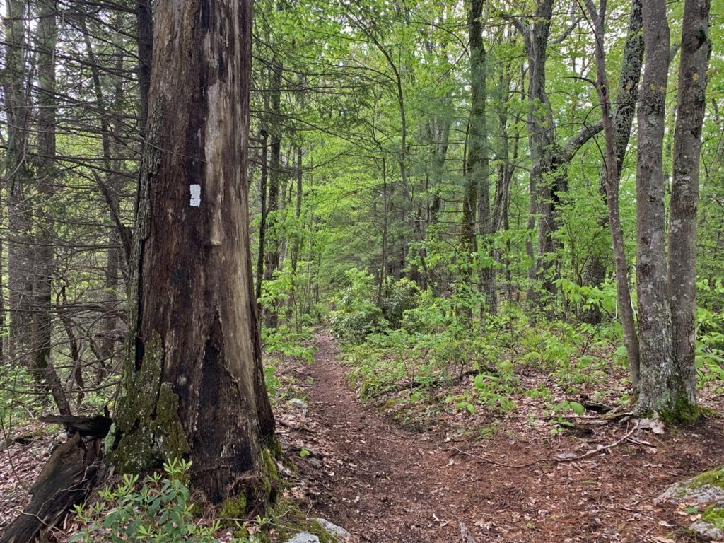
Indian “highway” as seen on the Appalachian Trail today. This is along the general route of the Native American “Great Trail” that ran the length of the Appalachian Mountains. It was a trail like this that would have run along the spine of Patapsco Neck.
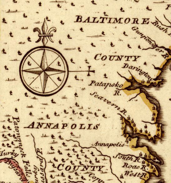
▴ Part of a map by Herman Moll (circa 1732) showing the “Patapsco River” (Native American derivation) as opposed to the “Bolus River” used by Captain John Smith for that river’s name. Bolus was derived from Latin and made reference to the lumpy red clay banks of the river he observed in his explorations. Patapsco came from how Native Americans described the river.
SETTLERS
When the King of England granted Maryland to Cecil Calvert and his family in 1632, he gave them ownership of all its lands. With the exception of a short period between 1689-1715, Calvert and his successors had full authority to sell and assign parcels of land as they saw fit. The document that conveyed land from the Lord Proprietor (Calvert) to the new owner was called a land patent, or patent, for short. From these patent records historians can piece together the history of land ownership in the state.
Patapsco Neck began to be settled in the 1650s. While still considered part of Anne Arundel County, in 1652, a land patent was assigned to Thomas Sparrow on Patapsco Neck. He named his patent “Sparrow’s Nest.” Since that time, the name Sparrow has been associated with the part of the Neck near the confluence of Bear Creek and the Patapsco River.
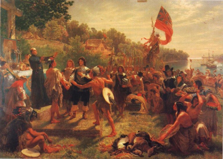
The Founding of Maryland 1634 by Emmanuel Leutze (Courtesy of Wikimedia Commons)
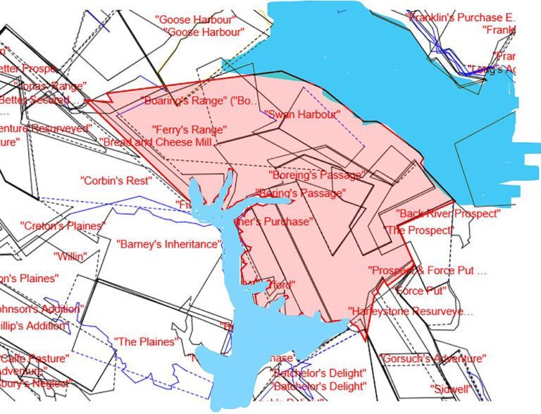
Lands surrounding the head of Bear Creek showing land patent names. “Barney’s Inheritance” is the land owned by Commodore Joshua Barney’s parents on Bear Creek. He spent his childhood there until he went to sea at age 12. Much of the Battle of Patapsco Neck took place on the rose shaded portion of the map in between Back River at the top and Bear Creek at the bottom. (Courtesy of Happy Mapmaker, Mike Pierce.)
Ralph Williams received a patent for land near the eastern tip of Patapsco Neck in 1665. He named his patent “the North Point.” In 1670, Thomas Todd received a patent for land that he named “Todd’s Range.” The family name is still in use through “Todd’s Inheritance” located on North Point Road. By the time of the War of 1812, about 136 land patents had been granted along Patapsco Neck. Among the family names of owners are those still familiar to us today: Stansbury, Todd, Jones, Gorsuch, Shaw, Lynch, and Sollers.
By 1800, although there were many farms on Patapsco Neck, much of the land was still covered by forest. Land owners were motivated by the tax code to leave much of their land in a virgin state since taxes were not levied on “unimproved” land. Other than farming, by 1798 the tax records show occupations in the area associated with milling, quarrying, brick making, kiln operations, and taverns.
The poorest of the families, both White and Black, were usually tenant farmers (renters) on someone else’s land. They earned their keep by working that land and keeping a small percentage of its produce or profit for themselves. Middle-class families, both White and Black, usually lived on farms they owned, sometimes owned an enslaved person to help in the fields, and often employed free African Americans to work in their kitchen and around the house. The wealthiest families, all White, lived on large plantations and employed large numbers of field workers, servants, and skilled tradespeople, both free and enslaved, both Black and White. Plantation owners often split their time between business pursuits in Baltimore City, public service, and operating their plantations.
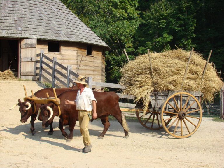
Oxen pulling a cartload of wheat to the barn. (Courtesy of George Washington’s Mount Vernon)
THE BLACK COMMUNITY
Within a few years after Maryland was founded, it had created counties that were subdivided into “Hundreds” for tax and voting purposes. Patapsco Neck was part of the “Lower Patapsco Hundred” that encompassed modern Patapsco Neck, Canton, Govanstown, the Jones Falls area, Towson and the land between them. It did not include Baltimore City. In general, Patapsco Neck was about 10% of the people of the Lower Patapsco Hundred. In 1810, the Lower Patapsco Hundred had a population of about 2,713 of which about 1,658 (61%) were White and 1,055 (39%) Black. Within the Black population, about 339 (43%) were free and about 715 (57%) were enslaved.
About 40% of the families in the Lower Patapsco Hundred were slaveholders. White households owned 94% of the enslaved people and Black households about 6%. It is generally believed by historians that formerly enslaved Black people often worked to purchase their own family members out of slavery. On paper, it would appear as if a free Black “owner” was enslaving other Blacks, when, in fact, they were trying to make them free by purchasing them. In the process, they became slave owners.
The average family size, White or Black, was about 5.5 people. The average residence was only about 450 sq ft in area. That meant the average person living in the Lower Patapsco Hundred in 1810 had about 75 sq ft of living space in their house or cabin. That’s roughly the amount of space allocated to each inmate in a federal prison today.

Baltimore County’s most famous free Black man in the late-18th Century was Benjamin Banneker. A surveyor, astronomer, mathematician and craftsman, Banneker worked to combat the misconception that Black people were inferior.
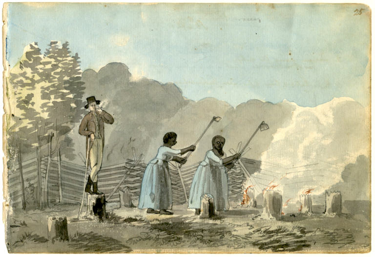
This scene shows a white overseer smoking a pipe and standing on a tree stump over two African American enslaved women who are using garden hoes. They are clearing the land. The trees have been felled, the stumps are being burned and the women are uncovering the roots of the stumps. (Watercolor by Benjamin Henry Latrobe circa 1798, from the Latrobe sketchbooks. Courtesy of the Maryland Center for History and Culture.)
Because enslaved Black people were considered property under the law, the family structure of enslaved Black people wasn’t recorded in census and tax assessment records. Consequently, although we know there was a family structure among enslaved people, we are unable to reconstruct that structure from existing records.
African Americans, whether free or enslaved, provided a great amount of skilled and unskilled labor within the Patapsco Neck community. Examples exist of both free and enslaved Black people engaged in skilled jobs in the trades, iron forging, lime kiln operations, brick production, shipbuilding, and as house servants. Equally available is evidence showing the employment of both free and enslaved Black people as unskilled and semi-skilled labor in the fields, clearing land, and general construction.
THE BRITISH ATTACK
PREPARATIONS ALONG PATAPSCO NECK PRIOR TO THE BRITISH ATTACK
In February 1814, in the second year of the War of 1812, British ships arrived to blockade Chesapeake Bay and punish the Chesapeake region for its support of the war. A few weeks later, Major General Samuel Smith of Baltimore, a former Revolutionary War officer, local merchant, Congressman, and US Senator, was ordered by Maryland Governor Levin Winder “to make the necessary arrangements for the defense of the port of Baltimore.”
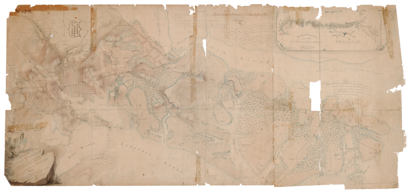
Military sketch of Patapsco Neck done by James Kearney based on reconnaissance by Maj. William Barney, son of famous US naval commander Commodore Joshua Barney. This is a reproduction of the sketch that was used by General Samual Smith to plan his defense of Baltimore. (Courtesy of NARA)
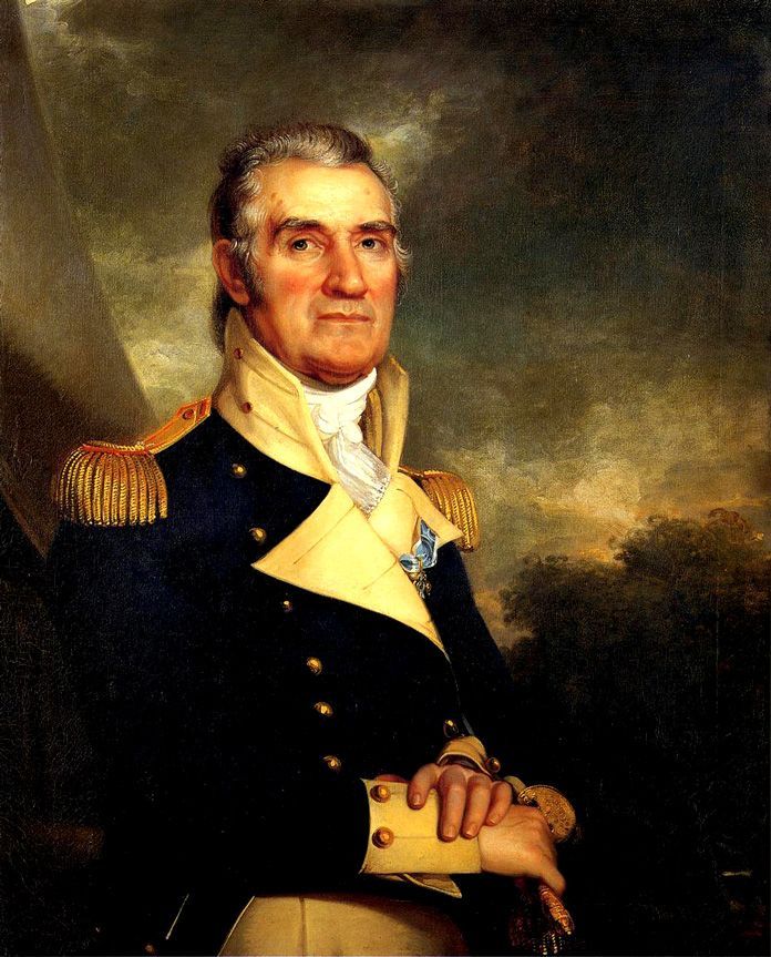
Major General Samuel Smith as painted by Rembrandt Peale. (Courtesy of Wikimedia)
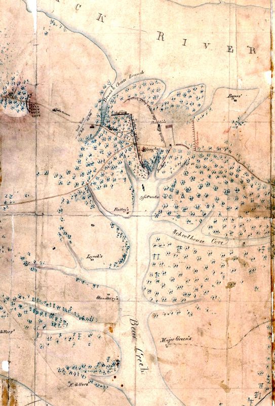
Portion of a reproduction of the Kearney map showing the length of Bear Creek as it almost cuts Patapsco Neck in half. (Courtesy of NARA)
In one of his first acts as commander, Smith ordered Major William B. Barney, a cavalry officer and son of Commodore Joshua Barney, whose family had long lived on Bear Creek, to lead a military reconnaissance of the land lying between Baltimore and the eastern tip of Patapsco Neck at North Point. On March 21, 1813, along with other officers, Barney set out to conduct that survey. His field notes and sketch of that reconnaissance was crucial to General Smith’s plans for Baltimore’s defense.
Analyzing Barney’s reconnaissance report, General Smith observed the many creeks and coves along Patapsco Neck. In particular, he noted two choke points along North Point Road the enemy would need to negotiate in order to advance to Baltimore. One was at the head of Humphrey’s Creek (near Edgemere), and the other at the head of Bear Creek (near what is Battle Acre today). Each of the two choke points would play a part in General Smith’s defensive plans.
It was at this place that General Smith planned to engage in battle with the British. In a brief spirited defense, his troops could bloody the enemy, gain intelligence, and provide his men limited fighting experience before retiring to the main US defenses on Hampstead Hill (Patterson Park) about six miles to its rear.
In one of his first acts as commander, Smith ordered Major William B. Barney, a cavalry officer and son of Commodore Joshua Barney, whose family had long lived on Bear Creek, to lead a military reconnaissance of the land lying between Baltimore and the eastern tip of Patapsco Neck at North Point. On March 21, 1813, along with other officers, Barney set out to conduct that survey. His field notes and sketch of that reconnaissance was crucial to General Smith’s plans for Baltimore’s defense.
Analyzing Barney’s reconnaissance report, General Smith observed the many creeks and coves along Patapsco Neck. In particular, he noted two choke points along North Point Road the enemy would need to negotiate in order to advance to Baltimore. One was at the head of Humphrey’s Creek (near Edgemere), and the other at the head of Bear Creek (near what is Battle Acre today). Each of the two choke points would play a part in General Smith’s defensive plans.
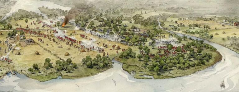
Painting of Battle of North Point. Notice Bear Creek’s head at the left top and Back River at its bottom. The battle is taking place on a small piece of land in between those two bodies of water at a choke point. (Painting by Richard Schlecht. Courtesy of the National Park Service)
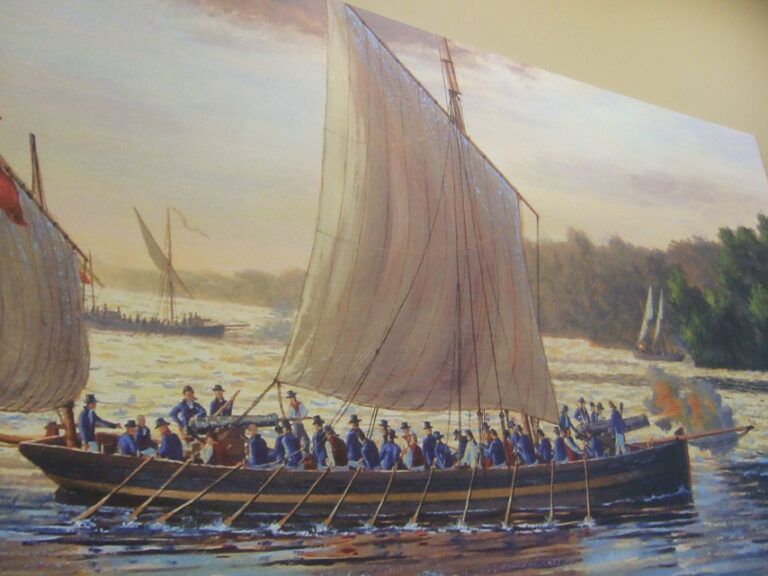
Gunboats like this were used by both the U.S. and Britain during the War of 1812. A number of British gunboats and armed barges entered Bear Creek at 1:00 PM on September 14, 1814, and engaged about 500 American riflemen on Sollers Point, approximately an hour before the beginning of the Battle of Patapsco Neck. (Art by Peter Rindlisbacher)
The second choke point, at the head of Bear Creek, held far more value for grinding away at the enemy’s strength. Similar to the land near the head of Humphrey’s Creek, the land at the head of Bear Creek could be turned into a linear defensive position anchored on each end by a water feature. The path along which the British would need to advance was only about 3,500 foot wide and was flanked to their left by the head of Bear Creek and to their right by marshland and Back River. The land consisted largely of flat farm fields. There were few places the British could take cover or hide.
Smith also knew Bear Creek could be a two-edged sword. In 1813, a year before the battle, as he watched the British Navy operating at the mouth of the Patapsco, he noted the speed and maneuverability of the British barges (longboats) that carried up to 50 soldiers, small cannons, and rockets. They took him by surprise. Easily unloaded from British ships, manned by experienced crews, he worried that in any future fight with the British at Bear Creek’s head, British barges might row up Bear Creek from its mouth on the Patapsco and cut off and capture his militiamen before they could return safely to Baltimore. While Bear Creek was an obstacle to the British Army, it was a highway to the British Navy.
In addition to preparing for a battle at the head of Bear Creek, Smith prepared for at least a skirmish at its mouth. During 1813, Smith sent various infantry regiments to encamp at that location, thereby providing experience to his green militia troops in how to protect Bear Creek from an incursion by British longboats.
ACTIONS ON PATAPSCO NECK DURING THE BRITISH ATTACK
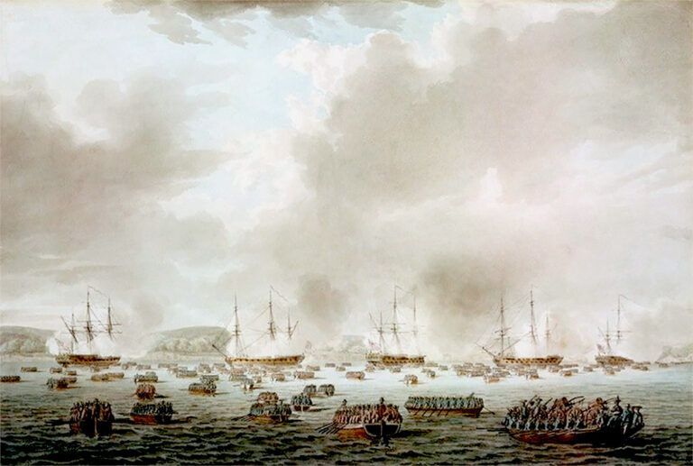
Painting of British landing at Kip’s Bay, New York, during the Revolutionary War. Their landing 38 years later at North Point would have looked very similar. (Painting by Robert Cleveley. Courtesy of Wikimedia)
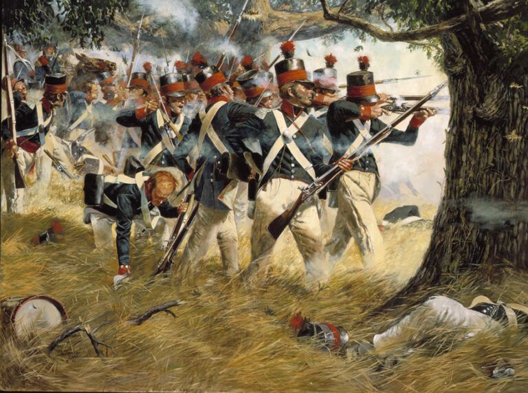
The Battle of North Point, by Artist Don Troiani. The elite 5th Maryland Regiment fiercely defend the American right flank during the Battle of North Point. (Courtesy of the National Guard Bureau)
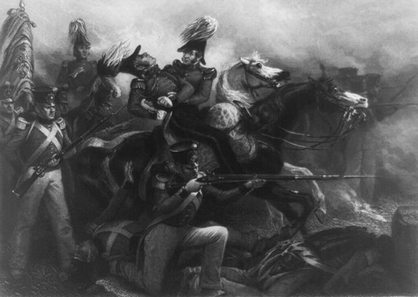
Death of General Ross by Alonzo Chappel. (Courtesy of the Library of Congress)
On September 11, 1814, the British Chesapeake Bay squadron entered the mouth of the Patapsco River with Baltimore as its target. Landing about 4,500 soldiers, sailors, and marines at North Point on Patapsco Neck’s eastern extremity, elements of the squadron continued to advance up the Patapsco River toward Baltimore. The small army it landed at North Point advanced toward Baltimore along North Point Road. As was their standard procedure, the British Army and Navy advanced parallel to each other, one on land, the other on water.
Warned of the British landing, the Americans – whose main defense was in Baltimore at Hampstead Hill – placed a temporary defensive line at the head of Bear Creek on Patapsco Neck. The American right was anchored on the head of Bear Creek, extended across North Point Road, and anchored its left on the marshy wooded ground near Back River. The American on-site commander, Brigadier General John Stricker, deployed his 3,185 men in three lines at a right angle to the Back River and Patapsco River.
Stricker also deployed 400 riflemen about four miles down Bear Creek near its mouth on Sollers Point at the homestead of Juliet Eliza Sollers. They were to guard against an attack by British longboats that might outflank his army’s right by attacking up Bear Creek. The riflemen were commanded by Major Beale Randall.
As the British army advanced toward Baltimore along North Point Road, it was engaged by a small force of Maryland militia shortly after departing Gorsuch Farm. During that small engagement, at about 1:30 PM on September 12, the British commander, Major General Robert Ross, was shot and mortally wounded. His subordinate, Colonel Arthur Brooke, took over command. They continued their advance along North Point Road.
At about the same time, a division of as many as 50 British longboats entered the mouth of Bear Creek four miles south near the Patapsco River. They carried a landing force of 1,500 men as well as cannons and rockets. Unaware of the battle that would soon occur at the head of Bear Creek, the boats were simply trying to gain control of the creek as a transportation path and communications link between the British Navy on the river and its army on Patapsco Neck. Randall’s riflemen on Soller’s Point were shot at by cannon, Congreve rockets, and small arms fire by the British attackers. The result was a small battle between the British boats and Randall’s riflemen on Soller’s Point. Fearing they would be cut off from other US forces, the American riflemen withdrew toward Colgate Creek nearer Baltimore.
About one and a half hours after the engagement at the mouth of Bear Creek, at approximately 3:00 PM on September 12, US forces and the British fought a pitched battle at the head of Bear Creek. Known at the time as the Battle of Patapsco Neck, it would later gain the name “The Battle of North Point.” After several hours of intense fighting, the US forces withdrew toward Baltimore. Bear Creek was entirely in British hands by sundown on September 12.
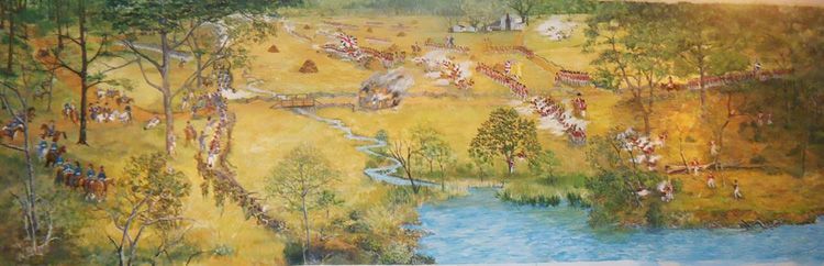
The Battle of North Point from the perspective of the head of Bear Creek. US on left and British forces on the right. Each have riflemen and skirmishers near the head of Bear Creek that are separated by a finger of water. (Painting by Tom Spicer. Courtesy of the National Park Service.)
A day later, on September 13, as the British moved toward Baltimore, a force of British soldiers set off from the vicinity of Colgate Creek advancing along Patapsco Neck toward Sollers farmstead on Bear Creek. In retribution for the Americans having used the Sollers homestead to attack the British, the British returned to burn that homestead.
On September 14, 1814, with Fort McHenry and Hampstead Hill undefeated, the British, unable to meet their military objectives, withdrew.
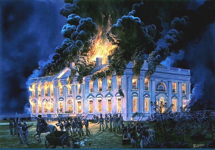
In the summer of 1814, the British attacked, seized, and burned Washington, DC. A few weeks later, when they attacked Patapsco Neck, they did the same to all buildings perceived to be used in the fight against the British. Todd’s Inheritance was burned as was Juliet Eliza Sollers’ farmstead on Sollers’ Point. (Painting by Tom Freeman. Courtesy of the White House Historical Association.)
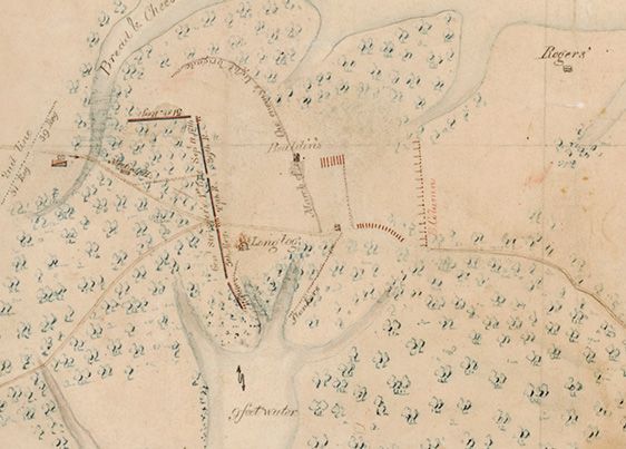
Battle of North Point as shown on what is thought to be the original Kearney map. At the bottom are the three main fingers of Bear Creek’s head. What looks like an upside down and backward “L” above Bear Creek is the American line of troops. Closest to the creek and on the south side of North Point Road is the 5th Regiment of Maryland Militia as well as American skirmishers at the very bottom. North of the road were the 27th Regiment and the 39th Regiment. At a right angle to them at the top was the 51st Regiment. British units are shown to the right in red.
THE REMEMBRANCE OF THINGS PAST
In the years following the British invasion, veterans and local citizens chose to remember the sacrifices made during the Battle of Patapsco Neck in various ways. Monuments were erected, commemorations enacted, and, more recently, living history programs involving both civilian and military re-enactors. Years after the battle, on July 21, 1817, US President John Quincy Adams visited Patapsco Neck to honor those who had fallen during the battle. The monuments and historic sites themselves are their own story.
AQUILA RANDALL MONUMENT
At the intersection of Old North Point Road and Old Battle Grove Road stands the second oldest military monument in Maryland and the third oldest in the United States. It is one of Maryland’s least visited War of 1812 sites – the Aquila Randall Monument – and is dedicated to honor Private Aquila Randall, who was killed in a skirmish just before the Battle of North Point on September 12, 1814.
On July 21, 1817, soldiers mustered in Baltimore and marched six miles to the North Point battleground. Accompanying them was President John Quincy Adams, who remarked, “The distance is about nine miles from the town, over a barren country, covered great part of the way with forest-trees, now undressing for the winter.” Accompanying them were wagons conveying the monument blocks to be assembled and dedicated on site that day.
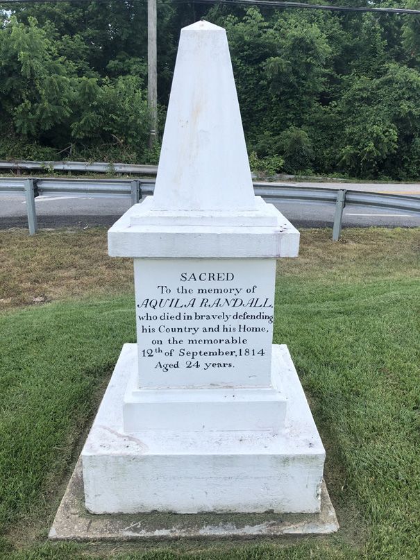
The Aquila Randall Monument as it appears today. (Courtesy of the Historical Marker Database)
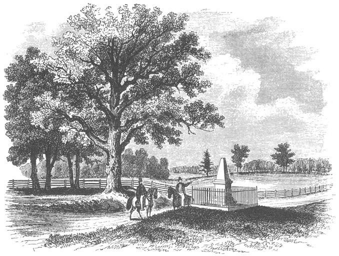
The Aquila Randall Monument as it appeared in 1869 in Lossing’s Pictorial Field-Book of the War of 1812. (Courtesy of the Historical Marker Database)
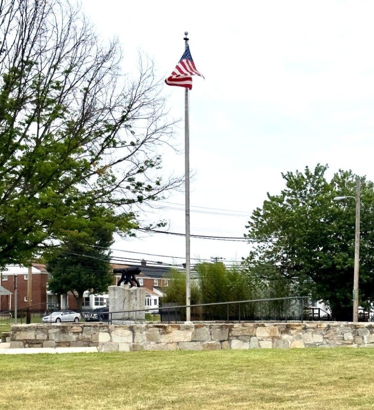
Battle Acre as it appears today along North Point Road in Dundalk. (Courtesy of Waymarking.com)
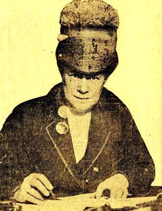
The Aquila Randall Monument as it appeared in 1869 in Lossing’s Pictorial Field-Book of the War of 1812. (Courtesy of the Historical Marker Database)
BATTLE ACRE
For the first twenty-five years after the Battle of North Point, most “September 12th” commemorations were held in Baltimore. On July 8, 1839, delegates from several militia companies who had fought at Patapsco Neck held a “Military Convention” at Baltimore’s City Hall. Representatives at the conference approved a newspaper ad asking for designs and cost estimates for placing a monument on the battleground.
A few weeks later, on September 11, 1839, local Baltimore businessman Jacob Houck donated an acre of land to the State of Maryland to be used as a site for the intended monument. That land became known as “Battle Acre.”
On the following day, September 12, 1839, the 25th Anniversary of the Battle of Patapsco Neck, a cornerstone ceremony was held at Battle Acre. The cornerstone was to serve as the foundation for the monument honoring those who had fought there. The ceremony was well attended by city and national officials including Supreme Court Justices and Cabinet officers. However, nothing came of the grand ceremony.
Battle Acre fell on hard times over succeeding decades.
By 1914, Mrs. Reuben Ross Holloway, granddaughter of Jacob Houck, succeeded in getting the Star-Spangled Banner Commission to perform some restoration work at the site. The work included erecting a large granite memorial stone at its center that was mounted with a small cannon from the War of 1812. A plaque was placed on the stone and a wrought iron fence installed around the acre
PERIODIC IMROVEMENTS OF THE BATTLEGROUND
Nearly 200 years after the battle, concerned local residents formed a committee to maintain and improve the Battle Acre site. In 2004, the Society for the War of 1812 in Maryland dedicated a new plaque. In 2005, a temporary repair of the Battle Acre flagpole and its lighting allowed the US flag to permanently fly over the park. Since then, the County has improved pedestrian access to the site, repaired and painted the wrought iron fence, and renovated six granite pillars. When the two wrought iron entry gates were stolen and destroyed in 2014, they were replaced through a donation by local resident Ed Hale of Dundalk. Since 2009, Battle Acre has been kept clean of trash and rubbish through the ongoing efforts of the non-profit organization Clean Bread and Cheese Creek under the leadership of local resident John Long.
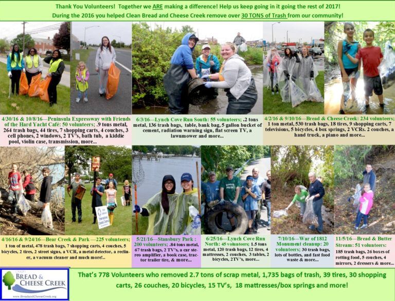
The monuments and historic sites are maintained on a seasonal basis by Clean Bread and Cheese Creek. Local volunteers offer their time, labor, and money to keep Patapsco Neck, Bread and Cheese Creek, and Bear Creek free of trash, rubbish, and toxic materials. (Courtesy of Clean Bread and Cheese Creek)
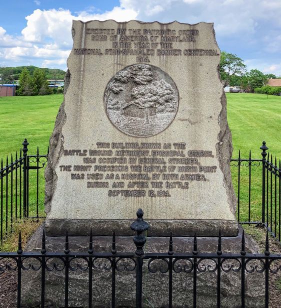
Memorial stone near Bread and Cheese Creek on the site of the original Methodist Meeting House near the North Point Battlefield. (Courtesy of the Baltimore Sun)
METHODIST MEETING HOUSE PROPERTY
The former Methodist Meeting House that stood near Bread and Cheese Creek was witness to all phases of the Battle of North Point. On September 11, 1814, a day prior to the battle, it was used by US forces as a muster point and field headquarters. On September 12, 1814, the day of the battle, it was used as a headquarters and field hospital by both sides dependent on which side controlled the field of battle. On September 13, 1814, the day after the battle, it served as a field hospital and its grounds as a morgue. In 1914, during the Star-Spangled Banner Centennial, the Patriotic Order, Sons of America, placed a granite monument and iron fence on the grounds and cemetery of the Patapsco Neck Battle Ground Meeting House.
THE FUTURE
While Baltimore’s defense from British attack was long ago, our need to recognize its importance remains. It is unique in American history since it marks the only time a city was asked to pay for its own defense from a foreign invader during a time of war. It is a perfect example of an entire community joining together in common cause and risking everything – wealth, land, businesses, and family members – to repel a foreign attack. It was a time when the top 1% socio-economic ladder of a city was as invested in saving that city as was the rest of the population. It was a time of which we should be proud, and of actions we should commemorate. Memorials are important.
There are important portions to the story of the defense of the port of Baltimore in 1814 that are still unrecognized, and some of them involve Patapsco Neck. While their significance is recognized by monuments and historic sites along North Point Road that commemorate the Battle of Patapsco Neck, nothing marks the significant role Bear Creek played in that battle.
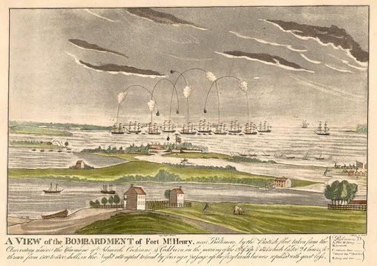
The attack that defined our community. (Lithograph by John Bower. Courtesy of the Library of Congress.)
Recognition should be made of the engagement involving nearly 2,000 soldiers, sailors, and marines, both American and British, at Juliet Eliza Sollers farm on Sollers Point at the mouth of Bear Creek. Similarly, in the area of Charlesmont Park, recognition should be made of its role in the transportation of the wounded and prisoners from the battlefield to the British fleet. Recognition that one of America’s most storied naval officers from both the American Revolution and the War of 1812, Commodore Joshua Barney, grew up on Bear Creek at his family’s home (Barney’s Inheritance) near Bear Creek Park has long been awaited. Finally, Bear Creek itself has changed little since 1814 upstream from Sparrows Point. Its historic landscape should also be recognized and commemorated.
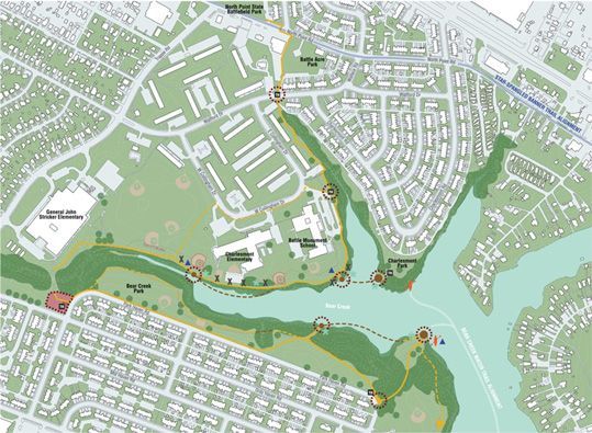
The interpretive trail at the head of Bear Creek currently being undertaken by NeighborSpace of Baltimore County will provide opportunities to commemorate significant historical people, events, and places. (Courtesy of NeighborSpace of Baltimore County)
ACKNOWLEDGEMENTS
We would be remiss if we didn’t recognize the following people and organizations who provided much-appreciated support to our research team.
GENEROUSLY FUNDED BY:
THE AMERICAN BATTLEFIELD PROTECTION PROGRAM
OF THE NATIONAL PARK SERVICE
CONTRIBUTING HISTORIANS
- Christos Christou, Jr
- Robert T. Cummins, Jr
- Ralph E. Eshelman
- Kevin Garrity
- Christopher T. George
- Ross M. Kimmel
- Steven X. Lee
- Edward C. Papenfuse
- Patricia Paul
- Robert Reyes
- Scott S. Sheads
COMMUNITY CONTRIBUTORS
- Robert Zacherl
- Francis Taylor
STEVENSON UNIVERSITY INTERNS
- Haley Mabe
- Amber D’Abundo
PRINCIPAL INVESTIGATOR
- Glenn T. Johnson
NEIGHBORSPACE EXECUTIVE DIRECTOR
- Phyllis Joris
RESOURCES
As shared, The Bear Creek Heritage Trail has been a project long in the works and there have been many steps we’ve undertaken to progress the community’s vision. Please feel free to download the supporting documents, such as grants, concept plans, and many other resources we leveraged to make The Bear Creek Heritage Park Trail reality.
PLANS
- Bear Creek Concept Plan Map
- Bear Creek Concept Plan Booklet
- Bear Creek Brochure
- Bear Creek Trail Phasing Plan
AMERICAN BATTLEFIELD PROTECTION PROGRAM GRANT MATERIALS
- Grant Application
- Grant Budget
- Expense Report
- Bear Creek Historical Project Meeting
- The Preceptor – Issue 1
- The Preceptor – Issue 2
- Final Historical Research Report
OTHER MATERIALS
- $110,000 Grant Will Fund Historical Research, Guide Design
ABPP Grant Release, 2021 - Battle Acre
Inventory Form from Md. Historical Trust - Battle Acre Dedication Photo
Image - Battle Acre Dedication: Description of Battle Ground
U.S. Commercial & Stat. Register, Phila. PA, 1839 - Brochure About the Trail
2021 - Community Hopes to Develop War of 1812 Trail
Baltimore Sun, Aug. 2, 2012 - Comprehensive Management Plan, Executive Summary
National Park Service - Comprehensive Management Plan, National Park Service
App 2 Focus Areas includes Md. Line Trail
- Facts about the Project
2019 - Feasibility Study for SSBNH Trail
National Park Service - Feasibility Study for SSBNHT Trail: Abstract
National Park Service - Measuring Trail Benefits: Property Values
Headwaters Economics - The Role of Bear Creek in the British Attack on Baltimore
Christopher George - Schools with Community Trail Connections-Details
Ursula Lemanski, NPS-RTCA - Schools with Community Trail Connections-Summary
Ursula Lemanski, NPS-RTCA